OpenFront · Maps · Guide
OpenFront Map Editor — How to Make Custom Maps
An OpenFront map editor guide: how the community custom map tool works, its terrain and nation tools, and how to export a map the game can load.
By the New Game Wiki team · Updated 2026-10-04
On this page (8)
- Is There an Official Map Editor?
- The Community Custom Map Editor
- Exporting and Using a Custom Map
- Does OpenFront have an official map editor?
- What can the community OpenFront map editor do?
- How do I use a custom map in OpenFront?
- Is the custom map editor hard to run?
- Can I import a real map image into the editor?
An OpenFront map editor is not part of the base client, but the game's map format is published as open source, and a community browser tool makes custom maps approachable. If you want to build your own terrain, define nation spawns or recreate a real-world region, this is the workflow to use. This page covers what exists, what the tool can do, and how to get a finished map into the game.
Is There an Official Map Editor?
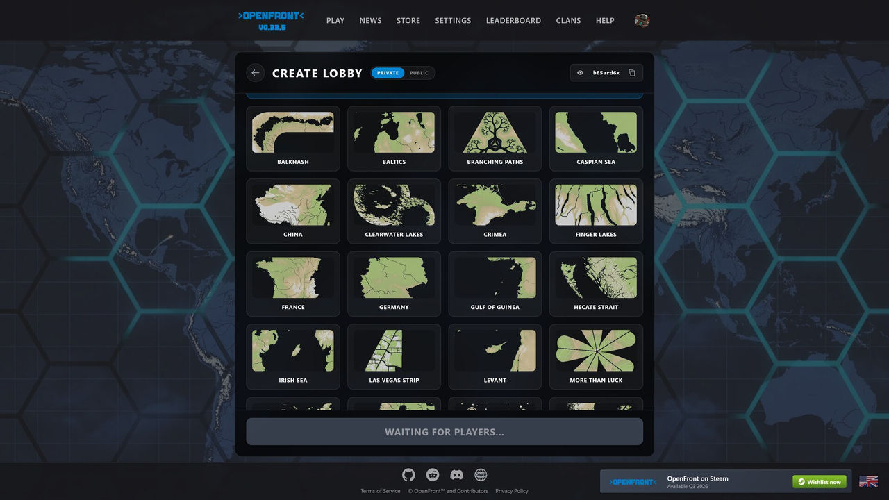
Not in the client. OpenFront is open source, and the OpenFrontIO repository ships a map-generator package that defines how maps are built and exported. The community wiki lists maps in groups including a large set of official ones and a separate "unused maps" entry, which is a reminder that the public client only serves a curated pool. Anything custom therefore lives in private lobbies, local builds and community projects rather than public matchmaking.
The Community Custom Map Editor
The tool most players find is Custom Map Editor - OpenFront, a client-side web application hosted at a community demo address. It requires no server and no account, and its documented feature set covers the whole pipeline from blank canvas to export.
| Feature | What it gives you |
|---|---|
| Visual brush painting | Paint land, water and nation spawn points directly on the canvas |
| Image import | Bring in an existing image at any size as a template to trace over |
| Elevation control | Set custom elevation levels for individual land tiles |
| Nation management | Define multiple nations with custom names and spawn locations |
| Live preview | A minimap updates instantly as you paint and zoom |
| Export | Produce a map in an OpenFront-compatible format as a bundle |
- Runs in the browser with no server component, so the hosted demo is the simplest entry.
- Performance-minded: the project notes it handles large maps with smooth painting, zooming and panning.
- Open source: the repository is public and licensed under MIT, so the code can be inspected and forked.
- Format-compatible: it credits and follows the map generation format from the OpenFront Map Generator.
Exporting and Using a Custom Map
The export step bundles your project into the format the game's map generator expects, along with a manifest and a thumbnail. Once exported, you use the map the same way a developer would: load it locally or in a private setting rather than expecting it to appear in the public map list, because the official client only rotates its own curated pool. A practical checklist keeps the result usable.
| Stage | What to check before moving on |
|---|---|
| Terrain | Every nation has reachable land and the water is painted where ports should be possible |
| Elevation | Elevation values are deliberate, because they decide how expensive each tile is to attack |
| Nations | Each spawn is named and placed so players are not boxed in with no expansion room |
| Preview | The minimap matches your intended shape before you export |
| Export | The bundle carries a manifest and thumbnail, and loads without errors |
- Start from an imported real-world image if you want recognisable geography, then paint over it.
- Keep at least some flat terrain around every spawn, because plains are the cheapest ground to take.
- Leave coastal tiles open on any map where you want ports to matter.
- Test in a private lobby before sharing, since public rotation will not accept it.
- For local development, install Node.js 18 or newer and use the project's install and build scripts.
FAQ
Does OpenFront have an official map editor?
OpenFront does not ship a built-in map editor in the client. What it does publish is open source: the OpenFrontIO repository includes a map-generator package, and community projects build editors on top of that format. The best-known one is a client-side web app called Custom Map Editor - OpenFront, which the wiki-listed repository describes as a tool for designing terrain, water bodies and nation spawn points without any server infrastructure.
What can the community OpenFront map editor do?
It is a browser-based visual editor. Its documented features include painting land, water and nation spawn points with a brush; importing an existing image as a template at any size; setting custom elevation levels for land tiles; defining multiple named nations with their own spawn locations; a live minimap preview; and exporting a map in an OpenFront-compatible format. It runs entirely client-side, so nothing is uploaded while you work.
How do I use a custom map in OpenFront?
The editor exports a bundled map in the format the game generator uses. Because OpenFront's public client only serves its curated map list, a custom map is best used in private lobbies and local or development setups rather than public matchmaking. The editor's own project notes credit the OpenFront Map Generator for the format, which is the reference to follow when checking compatibility.
Is the custom map editor hard to run?
The hosted demo needs nothing but a modern browser, which is the easiest route. Running it locally from source requires Node.js version 18 or higher plus npm or yarn, then the standard install, development and build commands. Most players never need the local route, because the hosted editor offers the same painting, elevation, nation and export tools.
Can I import a real map image into the editor?
Yes. Importing an existing image as a map template is a documented feature and it supports any size, which is the usual starting point for recreating a real-world region. You then paint over the imported image to set land, water and elevation, place nation spawns, and export the result once the minimap preview looks right.
More in Maps
More maps pages in OpenFront.
- OpenFront Maps — Full List, Sizes and Which Map to PickGuideUpdated 2026-10-04
References
- Maps - OpenFront.io Wiki
- zuperzonic1/Custom-Map-OpenFront — GitHub
- OpenFrontIO — map generator
- OpenFront — official web client
Facts on this page are compiled from the references above. Items marked "to confirm" are single-source and not yet verified.